Serving the Towns of Wawarsing, Crawford, Mamakating, Rochester and Shawangunk, and everything in between | |||
| |||


|
Thank You So Much, Dear Readers, For Your Continued Support! Read more...
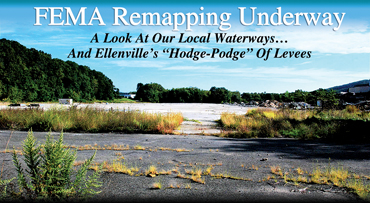
FEMA Remapping Underway
A Look At Our Local Waterways... And Ellenville's "Hodge-Podge" Of Levees
Flooding has been prominent in the news and general conversation lately with hurricanes inundating Houston, Florida and beyond. So the second Levee Analysis & Mapping Procedures (LAMP) meeting convened under FEMA/DEC auspices to consider Ellenville's levees and flood plains seemed quite topical on Tuesday, September 12. These meetings are part of FEMA's response to flooding that shook up many assumptions in our area when tropical storms Irene and Lee brought many inches of rain to the Catskills a few years ago. FEMA has been remapping flood plains, and the LAMP analysis will provide information that can be used by towns and counties as they work to improve levees. Less reassuring is the certainty that more people will find they need flood insurance and at the same time, flood insurance rates are going to rise. Of course, that will be much more dramatic in Florida than here, but looming behind talk of flood insurance is the current $25 billion in debt owed by the National Flood Insurance Program, even before the costs of Hurricanes Harvey and Irma are tallied. At the September meeting, Stephanie Nurre, Mapping Project Manager, explained how the process was going, how data had been collected and analyzed and what lessons Ellenville and Wawarsing could take from it. She outlined the analytical model, in which rivers and streams, and their flood plains are viewed from a set of different criteria. First is the Natural Valley view, which as it sounds is where the stream goes where it wants to, unchecked by human beings. Then comes a Structural Based Inundation Procedure, where levees and buildings are included. The key point now becomes the maintenance of some "freeboard" — between the top of the flooding stream and the top of the levee or wall holding it back. Beyond that is the Freeboard Deficient procedure and the Sound Reach Procedure. The last one has at least the minimum necessary freeboard. In all cases, the study is looking at 100-year floods. Of course, it is understood that these may be coming more frequently now. Brian Schug, Ellenville's building inspector, was quick to make the salient point from the village. "We're a small community with a hodge-podge of levees, and FEMA pushed themselves away from financial responsibility some time ago." Indeed, FEMA does not own many of the nation's levees and dams, they usually belong to the communities they protect. Schug and Joe Stoeckeler, village manager, are faced with the task of getting the village levees fully "accredited" with FEMA. Doing so, Schug added, would open up funding possibilities for further improvements and maintenance through the hazard mitigation program and the Governor's Office of Storm Relief (GOSR). Stoeckeler noted that the village has just spent $85,000 to buy a mower with the levees in mind. Nurre illustrated her words with "Effective FIRM" maps (Flood Insurance Rate Map) and the world of levees and flood plains rings with this term, which can be crucially important to property owners. Looking at Ellenville's three streams, the Sandburg Creek, the Beer Kill and the Fantine Kill, it was noted that they all come together in a confluence near the airport and past the site of the former Channel Master/Schrade factory. Nurre noted that the Sandburg Creek levee has plenty of space above the three feet minimum freeboard sought by FEMA. That levee is set on the western side of the creek, to protect the heart of the village of Ellenville and the school. The Beer Kill, which has levees on both sides, a mile's worth on the right bank and half a mile on the left, was analyzed. If the levee were to break, and three potential break sites were chosen, the Beer Kill would send a foot or so of water right across most of Ellenville. The worst place for a break would be up where Cape Avenue crosses the Kill, and water would cascade down Canal Street right into the heart of the town. However, Nurre said, most of the levees were above the three-foot freeboard level, but in the places where roads cross, there are vulnerabilities. The Fantine Kill, however, provided the worst set of issues. The Fantine Kill enters the village on its north side, above the site of the former Channel Master/Schrade factory complex. It crosses beneath Rte 209, and flows down past the factory site, which has now been largely cleared of the former structures. Nurre's breach analysis showed the levees here lacked sufficient freeboard. More than that, in the new analysis maps, the entire area of the former factory, now covered in a concrete slab, would flood to a depth of at least a foot of water. Considering that there are hazardous pollutants known to be on that site and under the slab, this has to raise major concerns. Other concerns exist. In a potential flood situation, which would come with the arrival of another hurricane in our area, Stoeckeler noted that the New York City Department of Environmental Protection (DEP) would, for its own good reasons, begin to release large volumes of water from the reservoirs, both the Rondout, above Ellenville, and the Ashokan, off to the north. The effect of this would be to raise the water levels in the Rondout and Esopus creeks. And then, when heavy rains produce inundations in the watershed, that water will be backed up a bit, which exacerbates the flooding potential along the levees in Ellenville. However, the DEP's primary responsibility is to the drinking water of New York City, held back by the dams, and not to the small communities here in the Rondout Valley. Nurre went on to add that more information was being sought, especially as her new analysis map differed from the currently existing FEMA map of flood plain risk in that area. The process continues, the third meeting envisioned for this flood analysis will take place in November, with the caveat that issues presented by the current flood disasters in Texas and Florida may affect that scheduling. Anyone who remembers the days of Irene and Lee, and possibly recalls standing on the Canal Street bridge over the Sandburg Creek when it was at its crest, right up to the top of the levee, and flooding over into Edwards Place, will understand how important this entire issue is.
Copyright © 2017, Electric Valley Media LLC | Terms of Use
All Rights Reserved. |
|
|||||||||||||||||||||||||||||||||